11.8 hr
Overview
This has the potential to be a classic destination ride. However, due to the lack of trail use and maintenance, portions of the trail will seem "frustratingly fantastic". Expect deadfall, duff and less than ideal conditions unless you get lucky and significant trail maintenance has been done recently. If you are lucky to ride it after it has been cleared it will be a ride you'll relish.<br><br>Many will shuttle this ride by starting near the Quaking Aspen Campground. That's fine, but diminishes the character of this great ride, which starts by climbing a portion of the awesome Nelson Trail to Cedar Slope which itself is great. <br><br>A good place to start in Camp Nelson is the general store near the large meadow and ride until Nelson Drive ends, which is about 1/4 mile past Belknap Campground. From where the roads end, the Nelson Trail starts nondescriptly at first by crossing the creek and then becomes more obvious. Continue up the Nelson Trail and cross the log bridge so you are now on the south side of the Tule River. <br><br>After 10 minutes, you should come to an obvious crossroad in which you go north and ford two creeks with no bridges and start the two-mile fireroad climb up to Cedar Slope and gain about 600'. Once at Cedar Slope, you transition to the paved CA-190 and ride 4.5 miles and 1,000' to Quaking Aspen Campground and the Great Western Divide Highway. The road does not get much traffic and the climb is enjoyable with a moderate gradient and nice scenery.<br><br>From Quaking Aspen, you take the Summit Trail from the south side of the campground loop which soon crosses a road before continuing up towards Slate Mountain. The trail switchbacks and kicks up as you ascend toward the confluence of the Summit Trail and Bear Creek Trail, which is five miles and 2,000' of elevation gain from the Campground. On this section, you'll encounter a couple of hiking sections before the saddle that takes you past Slate Mountain. <br><br>The junction to Bear Creek Trail is critical and not well marked so this is a
Trail Stats
37.5 km
1435 m
2735 m
1392 m
—
Photos
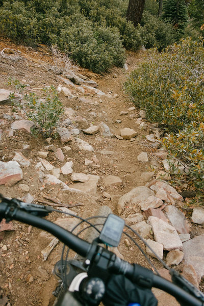
Steeper than it looks...
Steeper than it looks...

The ride crosses Boulder Creek under CA-190 in the Giant Sequoia National Monument.
The ride crosses Boulder Creek under CA-190 in the Giant Sequoia National Monument.

Trail through a tree.
Trail through a tree.