4.0 hr
Overview
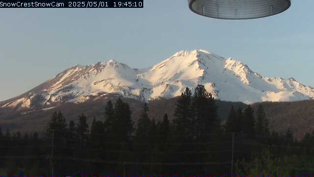
This camera is located at Shasta City, near the Pacific Crest Trail, 10 miles east of the PCT and 8 miles Southwest of Mt. Shasta, California. The view is from Snowcrest.net at an elevation of about 3,500 feet looking Northeast towards Mount Shasta. Map location for camera: Lat. 41.30109N Long. 122.34121W Camera courtesy of Snow Crest National Weather Service 7 Day History for Mt. Shasta, CA. Elev: 3533 ft; Latitude: 41.31583; Longitude: -122.31611
Trail Stats
16.1 km
—
—
—
—
Photos
Trail photo
No caption provided.
Trail photo
No caption provided.
Trail photo
No caption provided.

Trail photo
No caption provided.